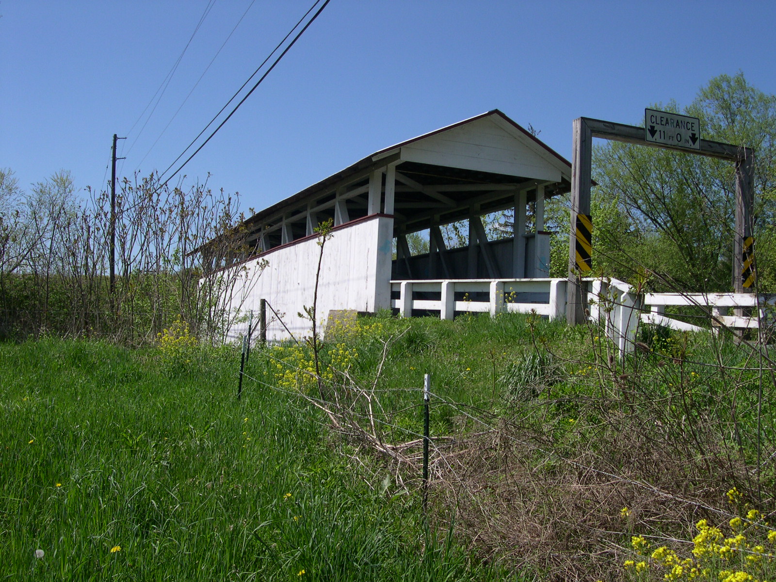
BEAVER
COUNTY
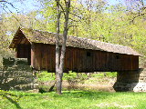 |
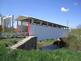
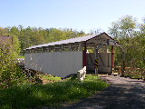
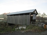
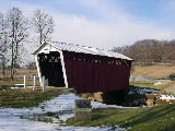
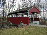
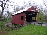
WOOLSLAYER
BRIDGE 38-04-A, Steel Queenpost Truss, is located in Brush Creek
Park, 4 miles NW of Beaver Falls.
The
GPS location is N40 47.78 & W80 14.35.
|
BEDFORD
COUNTY
 |
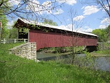
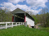
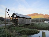
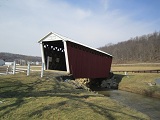
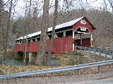
FELTON
MILL BRIDGE 38-05-03, Burr Arch Truss, built by W.S. Mullins in
1892. It is located on bypassed section of CR2009, WSW of Breezewood.
This photo was given to me by The First Vice President of the
Theodore Burr Covered Bridge Society of PA, Jim Smedley.
The
GPS location is N39 58.38 & W78 17.37.
|
 |
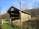
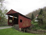
HERLINE,
KINTON BRIDGE 38-05-11#2, Burr Arch Truss, builder unknown, built
in 1902, & rebuilt in 1997. It is located on bypassed section
of CR4007, North of Manns Choice.
The
GPS location is N40 01.005 & W78 35.591.
|
 |
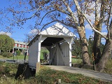
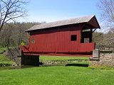
CLAYCOMB,
REYNOLDSDALE BRIDGE 38-05-12, Burr Arch Truss, builder unknown,
built in 1880. It is located at the entrance to Old Bedford Village,
North of Bedford. Walkway was added when it was moved there.
The
GPS location is N40 02.42 & W78 30.44.
|
 |
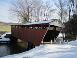
HALL'S
MILL BRIDGE 38-05-15#2, Burr Arch Truss, builder unknown, built
in 1872. The current bridge was built c1990. It is located on
St. Paul's Church Road (TR 528), on the Southern edge of Yellow
Creek.
The
GPS location is N40 07.46 & W78 19.02.
|
 |
DOCTOR
KNISLEY BRIDGE 38-05-16, Burr Arch Truss, builder unknown, built
c. 1870. It is located on west side of Dunnings Creek Road (CR4013),
SE of Pleasantville.
The
GPS location is N40 09.95 & W78 35.46.
|
 |
RYOT
BRIDGE 38-05-17#2, Burr Arch Truss, builder unknown, built in
1868. It is located on Bowser Road (TR 559), East of Ryot.
The
GPS location is N40 08.54 & W78 37.45.
|
 |
CUPPETT'S,
NEW PARIS BRIDGE 38-05-18, Burr Arch Truss, (on private land)
builder unknown, built in 1882. It is located on the east side
of PA96, North of New Paris.
The
GPS location is N40 06.97 & W78 38.38.
|
 |
DIEHL'S,
RAYSTOWN, TURNER, WILLIAMS BRIDGE 38-05-19, Burr Arch Truss, builder
unknown, built in 1892. It is located on Faupel Road (TR418),
West of Manns Choice.
The
GPS location is N40 00.58 & W78 38.90.
|
 |
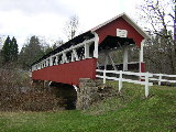
PALO ALTO, FITCHNER BRIDGE 38-05-21, Multiple King Post Truss,
builder unknown, built in 1880. It is located on south side of
bypassed section of Kennels Mill Road (CR3002), at the Western
edge of Palo Alto.
The
GPS location is N39 45.815 & W78 45.083.
|
 |
BOWSER,
OSTERBURG BRIDGE 38-05-22, Burr Arch Truss, builder unknown, built
in 1890. It is located on bypassed section of Covered Bridge Road
(TR575), WNW of Osterburg.
The
GPS location is N40 10.62 & W78 32.48.
|
 |
SNOOKS
BRIDGE 38-05-23, Burr Arch Truss, builder unknown, built in 1880.
It is located on Fish Hatchery Road (TR578), ESE of Pleasantville.
The
GPS location is N40 10.15 & W78 34.76.
|
 |
COLVIN,
CALVIN, SHILLER BRIDGE 38-05-24, Multiple King Post Truss, builder
unknown, built in 1880. It is located on Mill Road (TR443), SW
of Schellsburg.
The
GPS location is N40 02.30 & W78 39.26.
|
 |
JACKSON'S
MILL, BARNHART'S BRIDGE 38-05-25, Burr Arch Truss, built by Karns
Rohm in 1889. It is located on Covered Bridge Road (TR412), SW
of Breezewood.
The
GPS location is N39 58.29 & W78 16.30.
|
 |
HEWITT
BRIDGE 38-05-26 Burr Arch Truss, builder unknown, built in 1879.
It is located on Covered Bridge Road (TR305), SE of Hewitt. Refurbished
in 2000.
The
GPS location is N39 45.26 & W78 30.67.
|
GREENE
COUNTY
 |
CARMICHAEL'S
BRIDGE 38-30-21#2, Queenpost Truss, builder unknown, built in
1889. It is located on North Market Street near Greene Academy,
in Carmichaels.
The
GPS location is N39 53.92 & W79 58.63.
|
 |
KING
BRIDGE 38-30-24, Queenpost Truss, builder & date unknown.
It is located South of Kuhntown on King Sister Hill Road (TR371).
The
GPS location is N39 45.42 & W80 16.35.
|
 |
LIPPENCOTT,
COX FARM BRIDGE 38-30-25#3, Queenpost Truss, builder unknown,
built in 1943 and rebuilt in 2013. It is located on Woodies Road
(TR568), 3 miles East of Ruff Creek, 1/2 mile North of Lippincott.
The
GPS location is N39 56.59 & W80 07.55.
|
 |
NEDDIE WOODS, NETTIE WOODS BRIDGE 38-30-26, Queenpost Truss, built
by Lisbon Scott in 1882. It is located on Woods Road (TR487) one
mile North of Oak Forest.
The
GPS location is N39 51.78 & W80 14.09.
|
 |
SCOTT
BRIDGE 38-30-28, Queenpost Truss, built by William Lang in 1885.
It is located West of Rogersville, on Covered Bridge Road (TR424).
The
GPS location is N39 53.257 & W80 19.532.
|
 |
SHRIVER
BRIDGE 38-30-29, Queenpost Truss, builder unknown, built in 1900.
It is located South of Rogersville on Turkey Hollow Road (TR454).
The
GPS location is N39 51.17 & W80 16.76.
|
 |
WHITE
BRIDGE 38-30-30, Queenpost Truss, builder unknown, built in 1919.
It is located West of Garrard Fort, on Warren Roberts or Roberts
Run Road.
The
GPS location is N39 48.37 & W80 03.65.
|
 |
WREN'S
NEST BRIDGE 38-30-33, Kingpost Truss, commissioned by Richard
& Eloise Davison & built by Fred McCracken in 1993, blacksmith
work done by Cameron Tool. It is located North of Aleppo on Allepo
Road on the side of the road.
The
GPS location is N39 50.48 & W80 27.26.
|
HUNTINGDON
COUNTY
 |
ST.
MARY'S, SHADE GAP BRIDGE 38-31-01, Howe Truss, builder unknown,
built in 1889. It is located on Covered Bridge Road (TR358), NNW
of Shade Gap.
The
GPS location is N40 12.34 & W77 52.66.
|
INDIANA
COUNTY
 |
TRUSAL,
DICE BRIDGE 38-32-03, Town Lattice Truss, builder unknown, built
in 1870, has been renovated in 1998. It is located on Trusal Road
(TR406), off of SR 4006, between Willet & Davis.
The
GPS location is N40 43.83 & W79 11.05.
|
 |
HARMON
BRIDGE 38-32-04, Town Lattice Truss, built by John Carnahan in
1910 & renovated in 1998. It is located on bypassed section
of Donahue Road (TR488), off SR 4006, between Willet & Davis.
The
GPS location is N40 44.041 & W79 10.533.
|
 |
KINTERSBURG
BRIDGE 38-32-05, Howe Truss, built by J. S. Fleming in 1877, &
renovated in 1998. It is located on bypassed section of Musser
Road (TR612), near Kintersburg.
The
GPS location is N40 42.81 & W79 04.86.
|
 |
THOMAS
FORD, THOMAS STATION BRIDGE 38-32-06#2, Town Lattice Truss, built
by Amos Thomas in 1879 & reconstructed in 1998. It is located
on Covered Bridge Road (TR414), NE of Shelocta.
The
GPS location is N40 39.85 & W79 14.22.
|
SOMERSET
COUNTY
 |
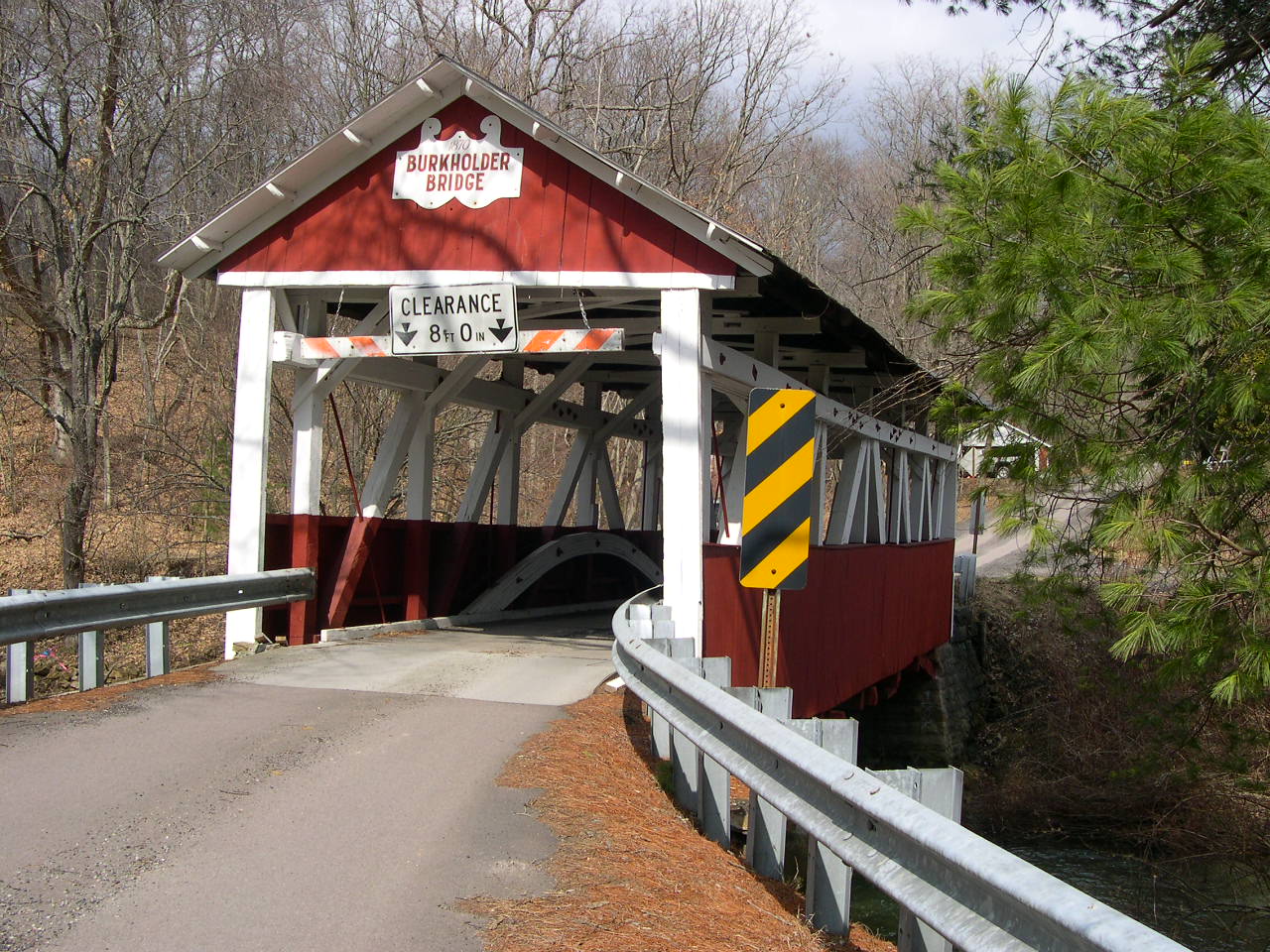
BURKHOLDER,
BEECHDALE, ALTHOUSE BRIDGE 38-56-01, Burr Arch Truss, builder
unknown, built in 1870. It is located on Burkholder Bridge Road
(TR548), NE of Garrett.
The
GPS location is N39 52.91 & W79 02.07.
|
 |
PACKSADDLE,
DOC MILLER BRIDGE 38-56-02, Kingpost Truss, builder inknown, built
in 1870, & restored in 1997. It is located on Pack Saddle
Road (TR407), NW of Fairhope.
The
GPS location is N39 52.05 & W78 49.03.
|
 |
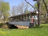
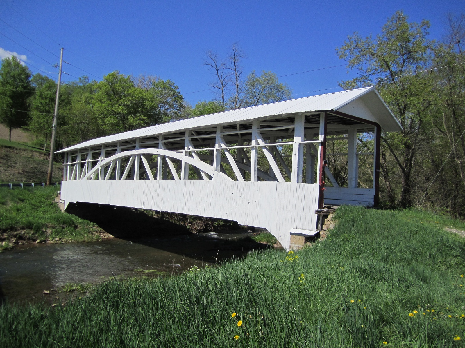
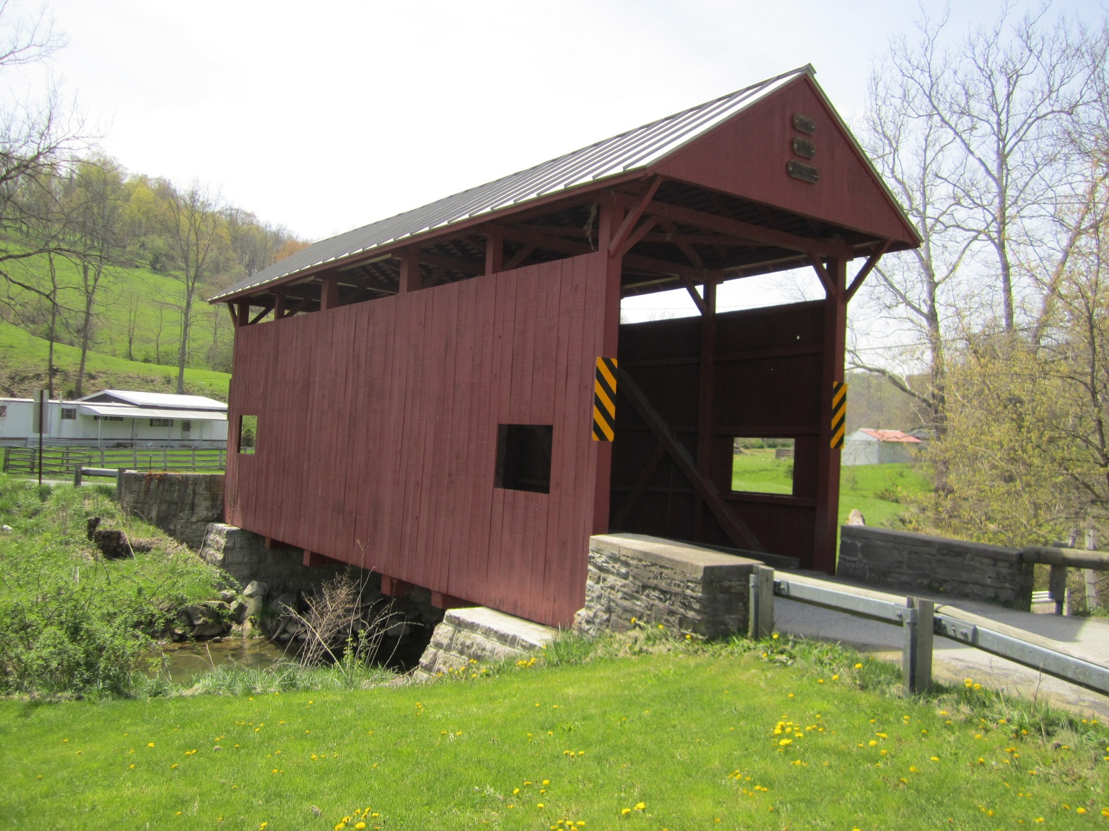
BARRONVALE
BRIDGE 38-56-03, Burr Arch Truss, built by Cassimer Cramer in
1902, (on private land). It is located on bypassed section of
SR3035, NW of New Lexington.
The
GPS location is N39 57.17 & W79 16.22.
|
 |
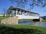
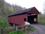
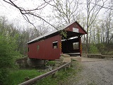
WALTER'S
MILL, COX CREEK, ROBERT'S BRIDGE 38-56-05, Burr Arch Truss, built
by Christian Ankeny in 1859. It is located at the Haupt Museum,
North of Somerset.
The
GPS location is N40 04.20 & W79 04.83.
|
 |
KING'S
BRIDGE 38-56-06, Burr Arch Truss, builder unknown, built in 1906.
It is located on bypassed section of PA653, SW of Somerset.
The
GPS location is N39 56.257 & W79 16.277.
|
 |
GLESSNER
BRIDGE 38-56-08, Burr Arch Truss, built by Tobias Glessner in
1880. It is located on Covered Bridge Road (TR565) NW of Shanksville.
The
GPS location is N40 01.56 & W78 55.25.
|
 |
NEW
BALTIMORE BRIDGE 38-56-09#2, Multiple King Post Truss, builder
unknown, built in 1879, rebuilt in 1996 after floods destroyed
it. It is located on Town Hill Road (TR812), on the Northeastern
edge of New Baltimore.
The
GPS location is N39 59.21 & W78 46.34.
|
 |
TROSTLETOWN,
KANTNER BRIDGE 38-56-10, Multiple King & Queen Variant Trusses,
builder unknown, built in 1845. It is located in Lions Club Park
in Stoystown.
The
GPS location is N40 05.77 & W78 56.72.
|
 |
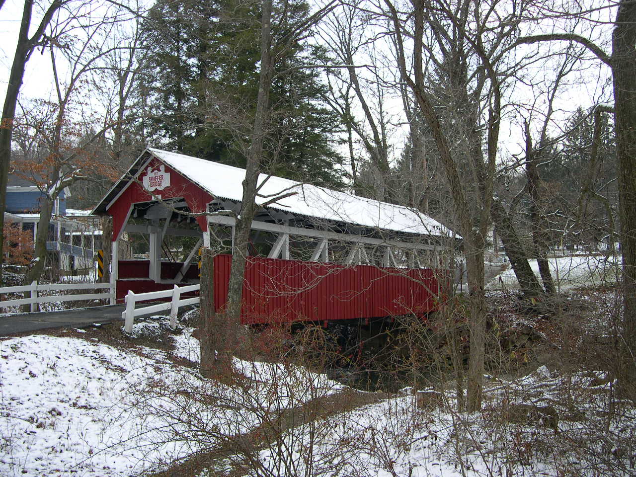
SHAFFER'S,
BEN'S CREEK BRIDGE 38-56-11, Burr Arch Truss, builder unknown,
built in 1877 It is located on Covered Bridge Road (TR634), West
of Ferndale.
The
GPS location is N40 16.87 & W78 57.84.
|
 |
LOWER
HUMBERT, FAIDLEY BRIDGE 38-56-12, Queenpost Truss, builder unknown,
built in 1891. It is located on dead end Covered Bridge Road (TR393),
North of Ursina.
The
GPS location is N39 50.41 & W79 19.38.
|
WASHINGTON
COUNTY
 |
SPROWLS
BRIDGE 38-63-03, Kingpost Truss, builder unknown, built in 1875.
It is located SW of East Finley on Newland School Road (TR450).
The
GPS location is N40 00.647 & W80 24.408.
|
 |
BAILEY
BRIDGE 38-63-08#2, Burr Arch Truss, built by the Bailey Brothers
in 1889, was arsoned in 1994-95 & re-built in 1999. It is
located off Exit 5 Interstate 79, on SR 2020 West of Interstate
79 on Bailey Road.
The
GPS location is N40 01.235 & W80 11.728.
|
 |
BROWNLEE,
STOUT BRIDGE 38-63-09, Kingpost Truss, builder & date unknown.
It is located in McGuffey Comunity Park, just West of Claysville.
The
GPS location is N40 06.572 & W80 25.374.
|
 |
CRAWFORD
BRIDGE 38-63-10, Queenpost Truss, builder & date unknown.
It is located NW of West Finley on Crawford Road (TR307).
The
GPS location is N39 59.942 & W80 28.358.
|
 |
DANLEY
BRIDGE 38-63-11, Queenpost Truss, builder & date unknown.
It is located North of Good Intent on Dogwood Hill Road (TR379).
The
GPS location is N40 03.307 & W80 26.370.
|
 |
DAY
BRIDGE 38-63-12, Queenpost Truss, builder unknown built c. 1875.
It is located South of Prosperity on Covered Bridge Road (TR339).
The
GPS location is N40 01.771 & W80 17.566.
|
 |
DEVIL'S
DEN. McCLURG BRIDGE 38-63-13, Kingpost Truss, builder & date
unknown. It is located at the Western edge of Florence, in Hanover
Township Park.
The
GPS location is N40 25.48 & W80 26.80.
|
 |
EBENEZER
CHURCH BRIDGE 38-63-14, Queenpost Truss, builder & date unknown.
It is located NW of Cokeburg on Mingo Creek Park Road (TR 449)
in Mingo Creek County Park.
The
GPS location is N40 11.51 & W80 02.41.
|
 |
ERSKINE
BRIDGE 38-63-15, Queenpost Truss, built by William Gordon in 1845.
It is located South of West Alexander on Erskine Road (TR314).
The
GPS location is N40 03.990 & W80 30.974.
|
 |
HENRY
BRIDGE 38-63-16, Queenpost Truss, builder unknown built c.1880.
It is located NW of Ginger Hill on Mansion Road (TR822) in Mingo
Creek County Park.
The
GPS location is N40 12.15 & W80 00.98.
|
 |
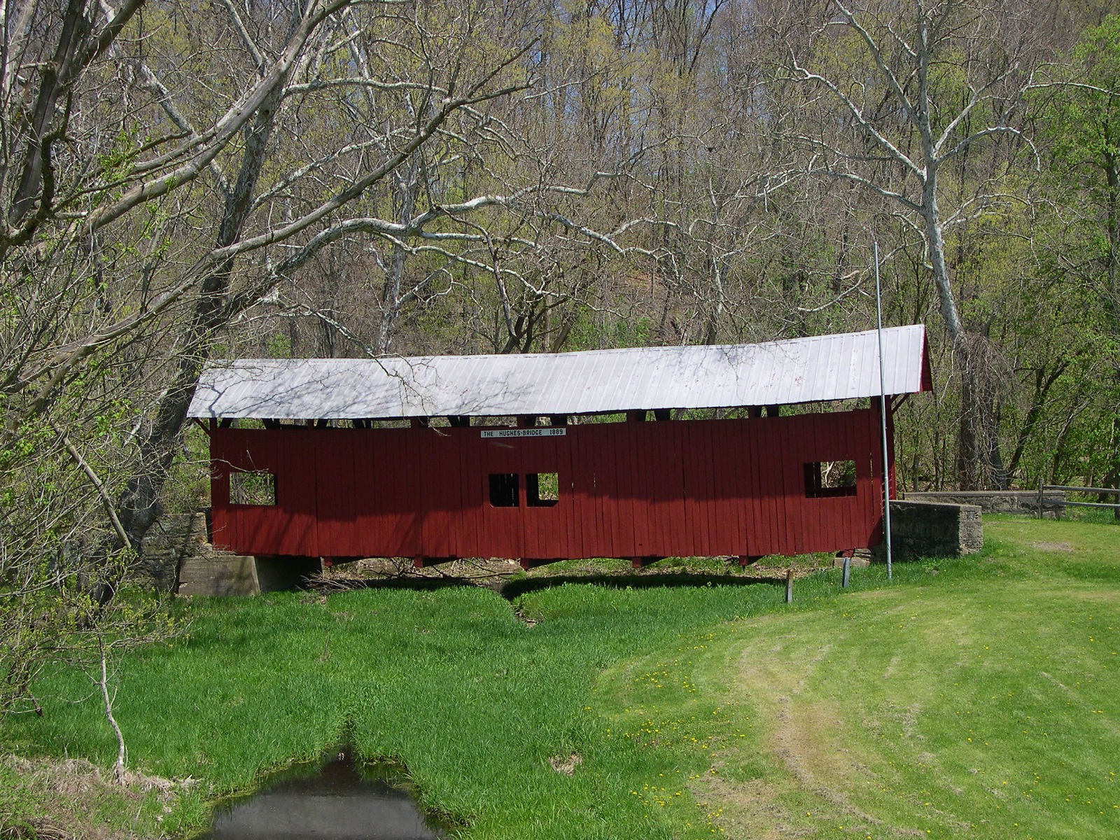
HUGHES
BRIDGE 38-63-17, Queenpost Truss, builder unknown, built in 1889.
It is located off Exit 5 Interstate 79 on bypassed section of
Montgomery Run Road (TR688) running parallel to I-79 Northbound.
The
GPS location is N40 01.364 & W80 10.367.
|
 |
JACKSON'S
MILL BRIDGE 38-63-18, Queenpost Truss, builder & date unknown.
It is located NNE of Paris on King's Creek Road (TR853).
The
GPS location is N40 25.44 & W80 29.35.
|
 |
KREPPS
BRIDGE 38-63-19, Kingpost Truss, builder & date unknown. It
is located SE of Cherry Valley on Covered Bridge Road (TR799).
The
GPS location is N40 20.451 & W80 19.863.
|
 |
LEATHERMAN
BRIDGE 38-63-20, Queenpost Truss, builder & date unknown.
It is located NW of Cokeburg on Leatherman Bridge Road (TR449).
The
GPS location is N40 07.21 & W80 05.49.
|
 |
LYLE
BRIDGE 38-63-21, Queenpost Truss, builder & date unknown.
It is located ENE of Florence on Kramer Road (TR861).
The
GPS location is N40 27.25 & W80 22.51.
|
 |
LONGDON
L. MILLER/LONGDON BRIDGE 38-63-22, Queenpost Truss, builder &
date unknown. It is located SSE of West Finley on Miller Creek
Road (TR414). It has been recently re-furbished.
The
GPS location is N39 58.70 & W80 26.75.
|
 |
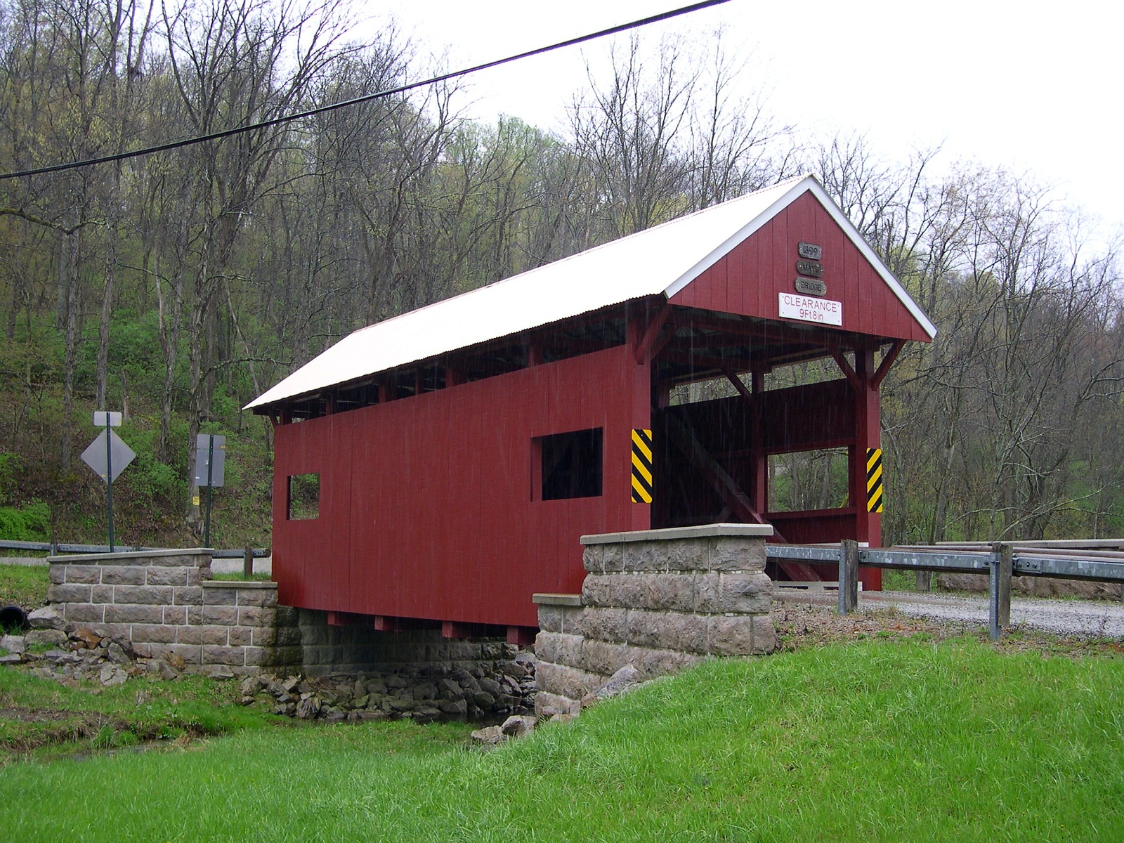
MAYS,
BLANEY BRIDGE 38-63-23, Queenpost Truss, builder & date unknown.
It is located SE of West Alexander on Waynesburg Road (TR423).
The
GPS location is N40 05.293 & W80 29.247.
|
 |
PLANT'S
BRIDGE 38-63-26, Kingpost Truss, builder & date unknown. It
is located West of East Finley on Sky View Road (TR408).
The
GPS location is N40 01.27 & W80 24.95.
|
 |
RALSTON,
FREEMAN BRIDGE 38-63-27, Kingpost Truss, builder unknown, built
in 1915. It is located North of Paris on dead end Ralston Road
(TR352). It is on private land.
The
GPS location is N40 26.89 & W80 30.33.
|
 |
WILSON'S
MILL BRIDGE 38-63-(c)is located on dry land on the Panhandle Trail
in McDonald.
The
GPS location was N40 22.057 & W80 14.036.
|
 |
WYIT
SPROWLS BRIDGE 38-63-29, Queenpost Truss, builder & date unknown.
It is located on PA231 in the East Finley Park.
The
GPS location is N40 02.30 & W80 24.19.
|
 |
WRIGHT,
CERL BRIDGE 38-63-30#2, Kingpost Truss, builder & date unknown.
It is located NW of Bentleyville on Sumney Road (TR802) off of
Interstate 70, on the Eastbound side.
The
GPS location is N40 09.54 & W80 02.91.
|
 |
SAWHILL
BRIDGE 38-63-34, Queenpost Truss. Builder unknown, built in 1915.
It is located NW of Taylorstown on Pole Cat Hollow Road (TR426).
The
GPS location is N40 10.81 & W80 24.97.
|
 |
PINE
BANK, MEADOWCROFT VILLAGE BRIDGE 38-63-35, formerly PA-63-06,
Kingpost Truss, builder unknown, built in 1870. It is located
WNW of Avella in Meadowcroft Village.
The
GPS location is N40 17.25 & W80 29.53.
|
 |
MORRISON
BRIDGE 38-63-B Stringer, is located east of Eight-Four on the
west side of Brownlee Road.
The
GPS location is Lat. N40 10.61 & W80 05.72.
|
WESTMORELAND
COUNTY
 |
BELLS
MILL BRIDGE 38-65-01, Burr Arch Truss, built by Daniel McCain
in 1850. It is located East of West Newton on Bells Mills Road
(SR3061).
The
GPS location is N40 13.15 & W79 42.62.
|
 |
NAUGLE
BRIDGE 38-65-A, Burr Arch Truss, (on private property) resembles
the New Baltimore bridge in Somerset County. It is located in
Laughlintown on Fish Hatchery Lane.
The
GPS location is N40 12.04 & W79 12.72.
|
|


