 |
POOL
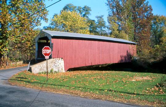
FORGE, WIMER BRIDGE 38-36-01 Burr Arch Truss, built by Levi Fink in 1859,
& by-passed in 1963. It is located on bypassed section of Pool Forge
Road, West of Churchtown.
The
GPS location is N40 07.792 W75 58.580.
|
 |
WEAVER'S
MILL, WHITE HALL BRIDGE 38-36-02 Burr Arch Truss, built by B.C. Carter
in 1879. It is located on Weaverland Road, North of Goodville.
The
GPS location is N40 08.47 W75 59.87.
|
|
|
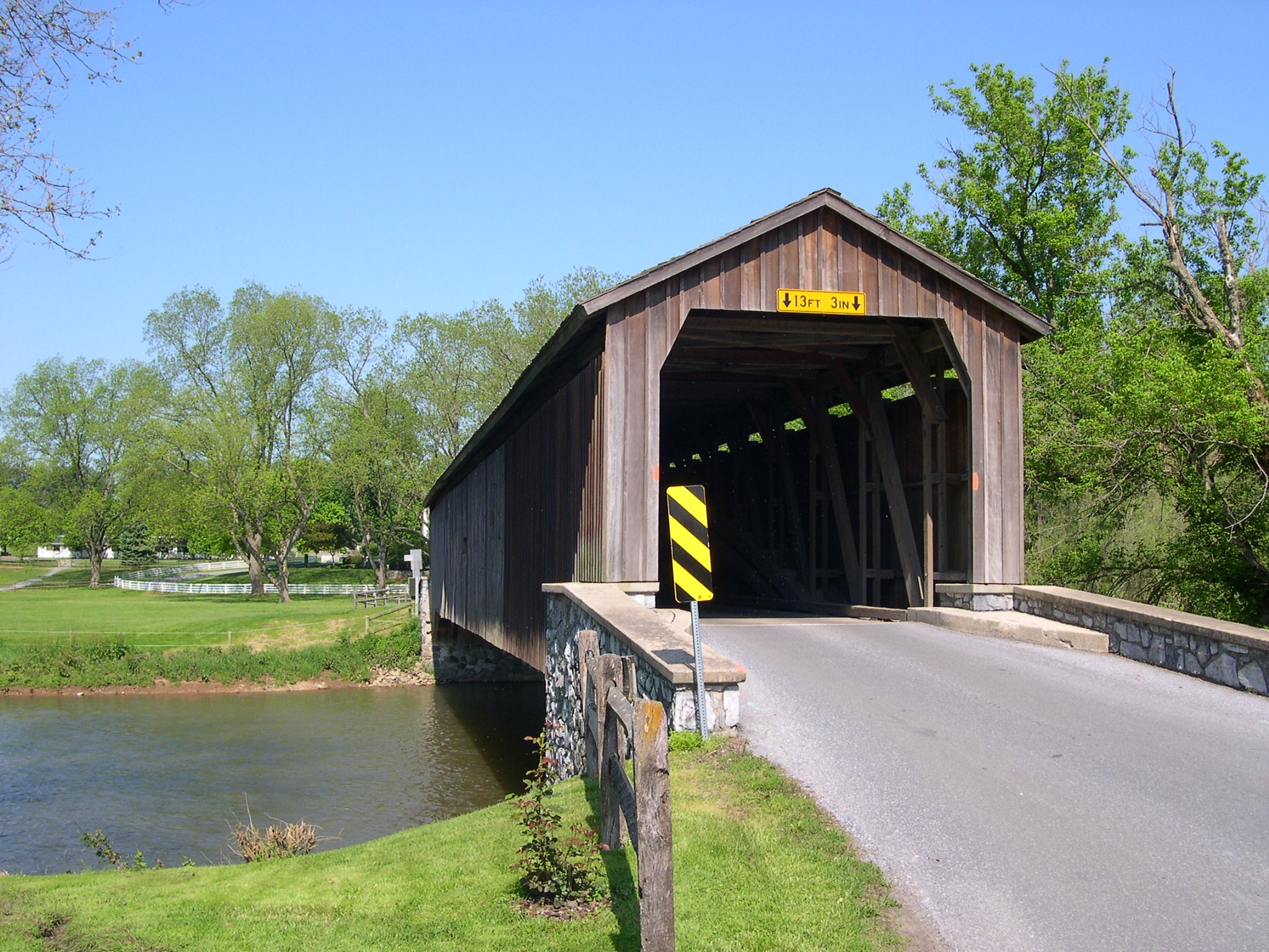
KURTZ'S
MILL, BEAR'S MILL BRIDGE 38-36-03 Burr Arch Truss, built by W.W. Upp in
1876. It is located in Greater Lancaster County Park, on Kiwanis Drive.
The
GPS location is N40 00.91 W76 16.93.
|
 |
BITZER'S
MILL, EBERLY'S BRIDGE 38-36-04 Burr Arch Truss, built by George Fink &
Samuel Reamsnyder in 1846. It is located on Cider Mill Road, SE of Ephrata.
The
GPS location is N40 08.425 W76 09.115.
|
 |
PINETOWN
ROAD BRIDGE 38-36-05 Burr Arch Truss, built by Elias McMellen in 1867.
It is located on Bridge Road, SW of Brownstown.
The GPS location is N40 06.339 W76 14.895.
|
 |
HUNSECKER'S
MILL BRIDGE 38-36-06#2 Burr Arch Truss, built by Joseph Russell in 1848.
It was destroyed by Hurricane Agnes in 1973, & rebuilt in 1975 by
the county. It is located on Hunsecker Road, on the NE edge of Lancaster.
The
GPS location is N40 05.244 W76 14.862.
|
 |
OBERHOLTZERS
MILL, RED RUN BRIDGE 38-36-10 Burr Arch Truss, built by Elias McMellen
in 1866. It is on private land in a campground. It is located on bypassed
section of Red Run Road (SR1044), SE of Reamstown.
The
GPS location is N40 10.52 W76 04.85.
|
 |
BUCHER'S
MILL BRIDGE 38-36-12 Burr Arch Truss, built by Elias McMellen in 1892.
It is located off Pa 272, on Cocalico Road.
The
GPS location is N40 12.47 W76 08.08.
|
 |
KELLER'S,
GUY BARD, RETTEW'S MILL BRIDGE 38-36-13#2 Burr Arch Truss, built by Elias
McMellen in 1873. It is now located on Middle Creek Road.
The
GPS location is N40 09.86 W76 13.95.
|
 |
ZOOK'S
MILL, ROSE HILL, WENGER BRIDGE 38-36-14 Burr Arch Truss, built by Henry
Zook in 1849. It is located on Log Cabin Road, WNW of Brownstown.
The
GPS location is N40 07.816 W76 13.883.
|
|
|
BUCK HILL, ABRAM HESS' MILL BRIDGE 38-36-15 Burr Arch Truss, (on private
land) built by Theodore D. Cochran in 1844. It is located off Pa 501,
South of Lititz. It is closed, private.
The GPS location is N40 07.926 W76 18.039.
|
 |
LANDIS
MILL BRIDGE 38-36-16 MULTIPLE KING Truss, built by Elias McMellen in 1878.
It is located on Shreiner Station Road behind Park City Mall.
The
GPS location is N40 04.08 W76 20.69.
|
 |
WHITE
ROCK FORGE BRIDGE 38-36-18#2 Burr Arch Truss, built by Elias McMellen
in 1849. It is located on White Rock Road (T337), South of Kirkwood.
The
GPS location is N39 49.48 W76 05.40.
|
 |
LEAMAN
PLACE, PARADISE, ESHELMAN'S MILL BRIDGE 38-36-20#2 Burr Arch Truss, built
by Elias McMellen in 1894. It is located on Belmont Road, East of Paradise.
The
GPS location is N40 00.72 W76 06.47.
|
 |
HERR'S
MILL, SOUDERSBURG BRIDGE 38-36-21 Burr Arch Truss, built by Joseph Elliot
& Robert Russell in 1885. It is located on bypassed section of Ronk's
Road at Mill Bridge Village, West of Paradise. It was damaded by fire
on November 17, 2014.
The
GPS location is N40 00.59 W76 09.73.
|
 |
NEFF'S
MILL, BOWMAN'S BRIDGE 38-36-22#3 Burr Arch Truss, built by James C. Carpenter
in 1875. It is located on Penn Grant Road, West of Strasburg.
The
GPS location is N39 58.70 W76 13.57.
|
 |
LIME
VALLEY, STRASBURG BRIDGE 38-36-23 Burr Arch Truss, built by Elias McMellen
in 1871. It is located on Breneman Road, off US 222, SE of Willow.
The
GPS location is N39 57.64 W76 14.10.
|
 |
BAUMGARDNER
BRIDGE 38-36-25#2 Burr Arch Truss, builder unknown, built in 1860. It
is located on Covered Bridge Road, NE of Martic Forge.
The
GPS location is N39 55.84 W76 17.71.
|
 |
FORRY'S
MILL BRIDGE 38-36-28 Burr Arch Truss, built by Elias McMellen in 1869.
It is located on Bridge Valley Road, East of Marietta.
The
GPS location is N40 04.06 W76 28.68.
|
 |
SHENCK'S
MILL BRIDGE 38-36-30#2 Burr Arch Truss, built by Levi Fink in 1855. It
is located on Erisman Road, North of Landisville.
The
GPS location is N40 06.96 W76 25.53.
|
 |
SHEARER'S
BRIDGE 38-36-31#2 Burr Arch Truss, built by Jacob Clare in 1856. It is
located in Veteran's Memorial Park in Manheim, at the north end of Adele
Avenue.
The
GPS location is N40 10.315 W76 23.386.
|
 |
KAUFFMAN'S
DISTILLERY BRIDGE 38-36-32#2 Burr Arch Truss, built by Elias McMellen
in 1874. It is located on Sun Hill Road, SW of Manheim.
The
GPS location is N40 08.89 W76 24.59.
|
 |
JACKSON'S
MILL BRIDGE 38-36-33#2 Burr Arch Truss, built by John Smith & Samuel
Stauffer in 1878. It is located on Mount Pleasant Road, South of Georgetown.
The
GPS location is N39 53.82 W76 06.80.
|
 |
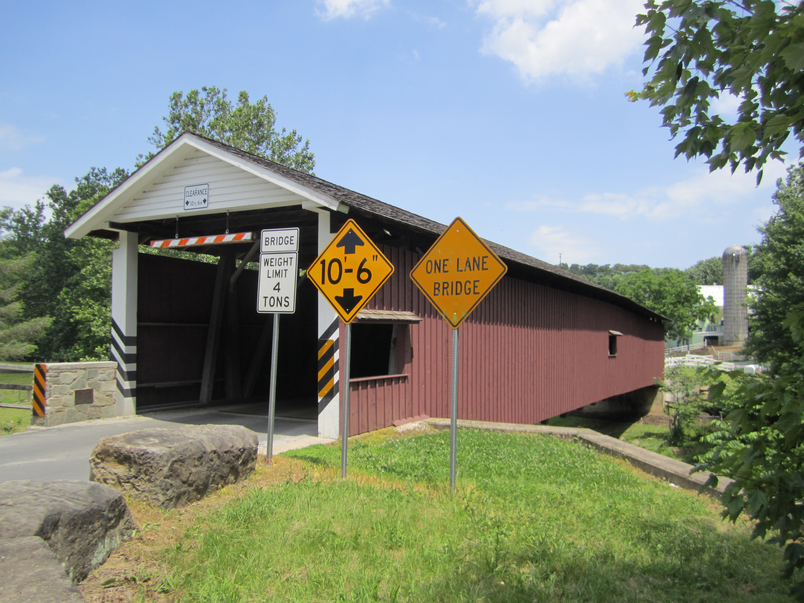
ERB'S
BRIDGE 38-36-34 Burr Arch Truss, built by John G. Bowman in 1887. It is
located on Erb Bridge Road, North of Rothsville.
The
GPS location is N40 10.04 W76 14.64.
|
 |
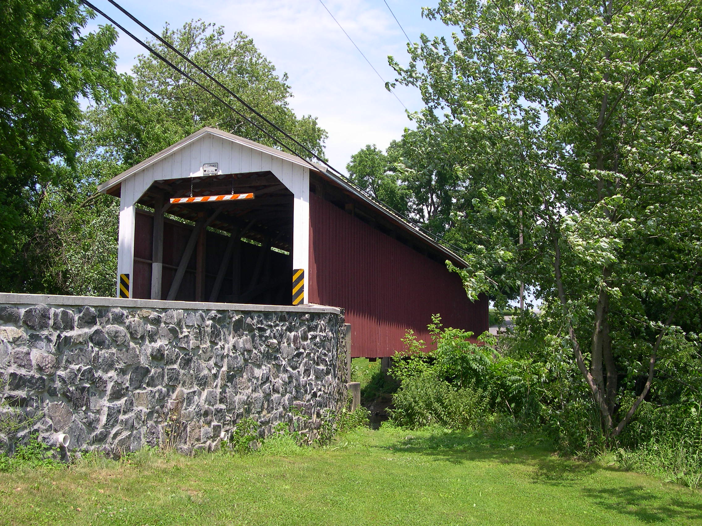
RISSER
MILL, HORST BRIDGE 38-36-36 Burr Arch Truss, built by Elias McMellen in
1849. It was located on Mount Pleasant Road, NE of Rheems. It was arsoned
on July 8th of 2002 & the remains removed on July 29th of 2002. |
|
|
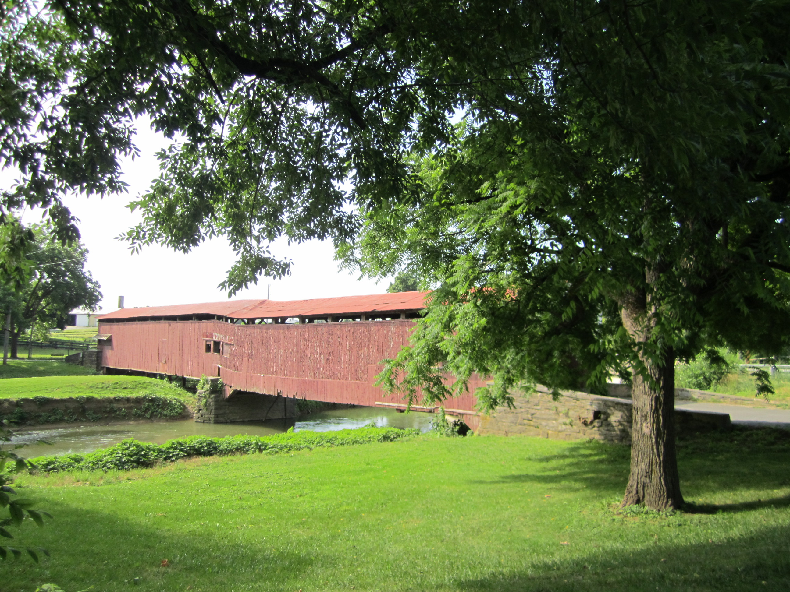
SEIGRIST'S
MILL, MOORE'S BRIDGE 38-36-37#2 Burr Arch Truss, built by James C. Carpenter
in 1885 and reconstructed in 2013. It was located on Seigrist Road, ENE
of Marietta.
The
GPS location is N40 04.55 W76 28.27.
|
 |
WILLOW
HILL, AMISH FARM BRIDGE 38-36-43 Burr Arch Truss, built by Roy Zimmerman
in 1962 using parts from two separate bridges (PA-36-24 & 27), Goods
Fording & the Miller's Farm bridge. It is located at the Willows Motel,
off US 30, and at the entrance to the Amish Farm Exhibit.
The
GPS location is N40 01.463 W76 12.093.
|
 |
COLEMANVILLE
MILL BRIDGE 38-36-55 Burr Arch Truss, builder unknown, built in 1856,
moved 75 feet and restored in 1989. It is located on Fox Hollow Road,
West of Martic Forge.
The
GPS location is N39 53.931 W76 20.533.
|
 |
WILLOW
VALLEY INN BRIDGE 38-36-b Stringer, made from parts of at least two covered
bridges. It is located at the resort, South of Lancaster.
The
GPS location is N39 59.63 W76 17.24.
|
 |
GEIB,
WHITE OAK, 38-36-j, Stringer, built in 1975. This bridge is located on
White Oak Road NE of Manheim.
The
GPS location is N40 11.83 W76 23.44.
|
 |
RISSER
MILL REPLICA BRIDGE 38-36-bb, Stringer, built in 2001, is located north
of Mount Joy, off Risser Mill Road.
The
GPS location is N40 08.04 W76 30.54.
|


