BERKSHIRE
COUNTY
 |
UPPER
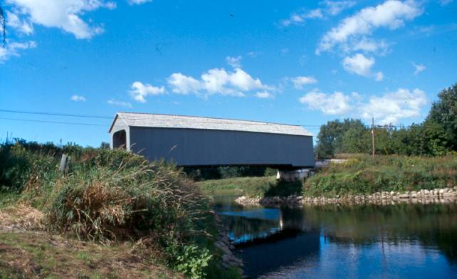
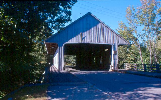
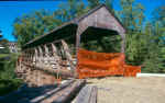
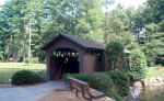
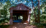
SHEFFIELD BRIDGE 21-02-01#2, Town Lattice Truss, built in 1832,
arsoned in 1995, rebuilt in 1998. It is located on Covered Bridge
Lane, between Route 7 & Boardman Road in Sheffield.
The
GPS location is N42 07.44 W73 21.28.
|
ESSEX
COUNTY
 |
SAWYER
POND BRIDGE 21-05-13, Town Lattice Truss, built in 1990 is located
at 138 Magnolia Ave.
The
GPS location is Lat. N42 35.46 W70 43.13.
|
FRANKLIN
COUNTY
 |
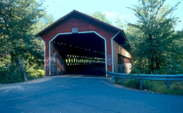
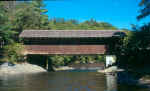
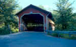
BURKEVILLE,
CONWAY BRIDGE 21-06-01, Howe Truss, built in 1870, was rebuilt
in 1999. It is located West of Conway on Poland Road.
The
GPS location is N42 30.468 W72 42.665.
|
 |
PUMPING
STATION BRIDGE 21-06-02#2, Howe Truss, built in 1972 to replace
a much older bridge. It is located NNW of Greenfield, on Eunice
Williams Road.
The
GPS location is N42 38.791 W72 37.209.
|
 |
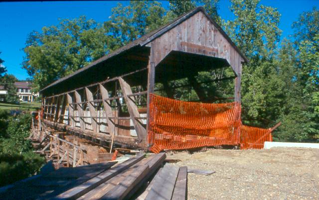
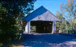
ARTHUR
SMITH BRIDGE 21-06-03#2, Burr Arch Truss, built in 1870, rebuilt
in 2006. It is located West of Colrain in the town of Lyonsville
on Lyonville Road. It has been placed over the river again. It
is closed to motor traffic.
The
GPS location is N42 40.194 W72 43.134.
|
 |
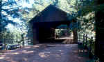
BISSELL
BRIDGE 21-06-04#2, Long Variation, built in 1951. It is located
North of Charlesmont on MA 8A. It was rebuilt in 2009.
The
GPS location is N42 37.899 W72 52.134.
|
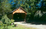 |
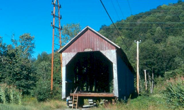
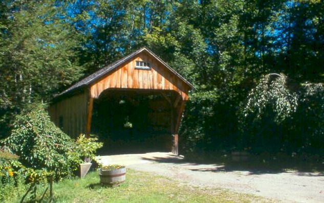
CREAMERY
BROOK BRIDGE 21-06-11, Queenpost Truss, built in 1985 by owner
Dwight Scott. It is located North of Ashfield on a private driveway,
off Creamery Road.
The
GPS location is N42 31.181 W72 48.046.
|
HAMDEN
COUNTY
 |
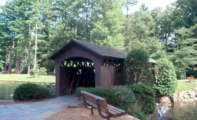
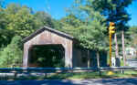
GOODRICH
BRIDGE 21-07-a, Town Lattice Truss, built in 1965, as a footbridge.
It is located West of Westfield in "Stanley Park".
The
GPS location is N42
07.40 W72 46.87.
|
HAMPSHIRE/WORCESTER
COUNTY
 |
GILBERTVILLE,
BRIDGE ST. BRIDGE 21-08-04 & 21-14-01, Town Lattice Truss,
built in 1886 & restored in 1986. It is located on western
edge of Gilbertville, on Bridge Street. It is shared with Worcester
county.
The
GPS location is N42 18.610 W72 12.732.
|
MIDDLESEX
COUNTY
 |
PEPPERELL
21-09-01#3, Pratt Truss Variant, built in 1963, rebuilt in 2010,
is located at East Peperell on Groton Road.
The
GPS location is N42
40.18 W71 34.51.
|
 |
WORCESTER
COUNTY
 |
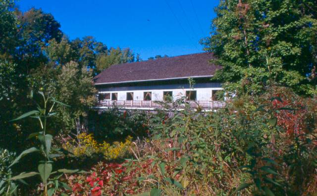
VERMONT,
DUMMERSTON, TAFT BRIDGE 21-14-03, Town Lattice Truss, built in
Vermont c.1870, is located in Old Sturbridge Village between the
tavern and farm area.
The
GPS location is N42 06.35 W72 05.72.
|
 |
SERVICE
21-14-M, Town Lattice Truss w/cement floor, built in Vermont c.1870,
was also located in Old Sturbridge Village. To my knowledge, it
is gone.
The GPS location is N42
06.34 W72 05.60.
|
|