|
Gibson
County
 |
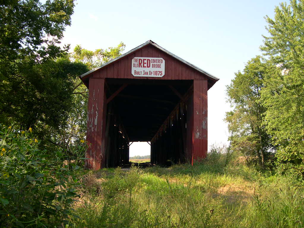
OLD
RED BRIDGE 14-26-01, Smith Truss, built in 1875, is located on
CR1675W (CR1660W). (Closed, Bypassed)
The
GPS location is N38 15.50 W87 52.76.
|
 |
WHEELING
BRIDGE 14-26-03, Smith Truss, built in 1877, is located on the
south side of Moore's Bridge Road NE of Princeton on CR400N. (Closed,
Bypassed)
The
GPS location is N38 24.71 W87 27.43.
|
Greene
County
 |
RICHLAND CREEK, PLUMMER BRIDGE 14-28-01, Burr Arch
Truss, built in 1883, is located South of Bloomfield on Base Road.
The
GPS location is N38 59.58 W86 56.27.
|
Lawrence
County
 |
WILLIAMS
BRIDGE 14-47-02, Howe Truss, built in 1884, is located WSW of
Williams on Huron-Williams Road (CR1000W).
The
GPS location is N38 47.806 W86 39.910.
|
Marion
County
 |
TRADERS
POINT, D. W. BROWN BRIDGE (VERY PRIVATE), 14-49-07, Howe Truss,
built in 1880, is located at 9151 86th street on left side going
west 0.6 mile west of I-65 underpass, NW of Indianapolis. No admittance,
reference only.
The
GPS location is N39 54.534 W86 19.444.
|
Owen
County
|
CATARACT
FALLS BRIDGE 14-60-01, Smith Truss, built in 1876, restored in
2005, is located on Cataract Road (CR1000N)Road.
The
GPS location is N39 26.00 W86 48.80.
|
Perry
& Spencer County
 |
HUFFMAN
MILL BRIDGE 14-62-01 & 14-74-01, Burr Arch Truss, built in
1884, is located North of Troy on west side of CR 29.
The
GPS location is N38 06.24 W86 46.61.
|
Putnam
County
|
CORNSTALK
BRIDGE 14-67-01, Burr Arch Truss, built in 1917, is located WNW
of Roachdale on W CR1350N.
The
GPS location is N39 51.78 W86 52.10.
|
|
HILLIS,
BAKERS CAMP BRIDGE 14-67-02, Burr Arch Truss, built in 1901, is
located on
(E CR650N), ESE of Bainbridge.
The
GPS location is N39 44.95 W86 46.51.
|
|
PINE
BLUFF BRIDGE 14-67-03, Howe Truss, built in 1905, is located NE
of Bainbridge on CR950N, becomes (N CR425E).
The
GPS location is N39 47.596 W86 46.413.
|
|
ROLLINGSTONE
BRIDGE 14-67-0, Burr Arch Truss, built in 1915, is located NE
of Bainbridge on CR800N.
The
GPS location is N39 46.485 W86 47.055.
|
|
EDNA
COLLINS BRIDGE 14-67-06, Burr Arch Truss, built in 1922 by Charles
Collings, is located ESE of Bellmore on CR450N.
The
GPS location is N39 43.65 W86 58.58.
|
|
DUNBAR
BRIDGE 14-67-07, Burr Arch Truss, built in 1880, is located NW
of Greencastle on CR125S.
The
GPS location is N39 39.52 W86 53.00.
|
|
OAKALLA,
SHOPPELL BRIDGE 14-67-10, Burr Arch Truss, built in 1898, is located
SW of Greencastle on CR375W.
The
GPS location is N39 37.56 W86 55.02.
|
|
HOUCK
BRIDGE 14-67-11, Howe Truss, built in 1880, restored in 1994,
is located WNW of Putnamville on CR550S.
The
GPS location is N39 34.929 W86 56.317.
|
|
WEBSTER,
DICK HUFFMAN BRIDGE 14-67-13, Howe Truss, built in 1880 is located
SW of Putnamville on CR1050S.
The
GPS location is N39 30.495 W86 57.466.
|
Vermillion
County
|
HILLSDALE
BRIDGE 14-83-03, Burr Arch Truss, built in 1876, is located on
the north side of US36 in Ernie Pyle Park.
The
GPS location is N39 47.84 W87 27.30.
|
|
NEWPORT,
MOREHEAD BRIDGE 14-83-04, Burr Arch Truss, built in 1885, is located
WNW of Newport on CR50N.
The
GPS location is N39 53.48 W87 26.00.
|
|
EUGENE
BRIDGE 14-83-05, Burr Arch Truss, built, in 1885, is located in
Eugene on North Elm Tree Road (Main Street).
The
GPS location is N39 58.15 W87 28.39.
|
Vigo
County
|
IRISHMAN,
FOWLER PARK BRIDGE 14-84-01, Queenpost Truss, built in 1845, is
located south of Terre-Haute on East Oregon Church Rd. at the
entrance to Fowler Park on N. side of the road.
The
GPS location is N39 20.30 W87 22.30.
|
|