|
BARTHOLOMEW
COUNTY
 |
NEW
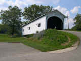
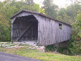
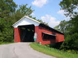
BROWNSVILLE BRIDGE 14-03-08, Long Truss, built in 1840, is located
at the western edge of Columbus in Mill Race Park.
The
GPS location is N39 12.383 W85 55.751.
|
BROWN
COUNTY
 |
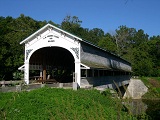
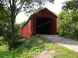
BEAN
BLOSSUM BRIDGE 14-07-01, Howe Truss, built in 1880, is located
SW of Bean Blossum on Covered Bridge Road.
The
GPS location is N39 15.66 W86 15.32.
|
 |
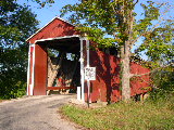
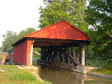
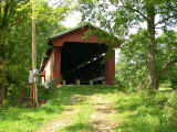
RAMP
CREEK BRIDGE 14-07-02, Double-Barrelled Burr Arch Truss, built
in 1838, is located at the entrance to Brown County State Park.
The
GPS location is N39 11.72 W86 12.99.
|
DEARBORN
COUNTY
 |
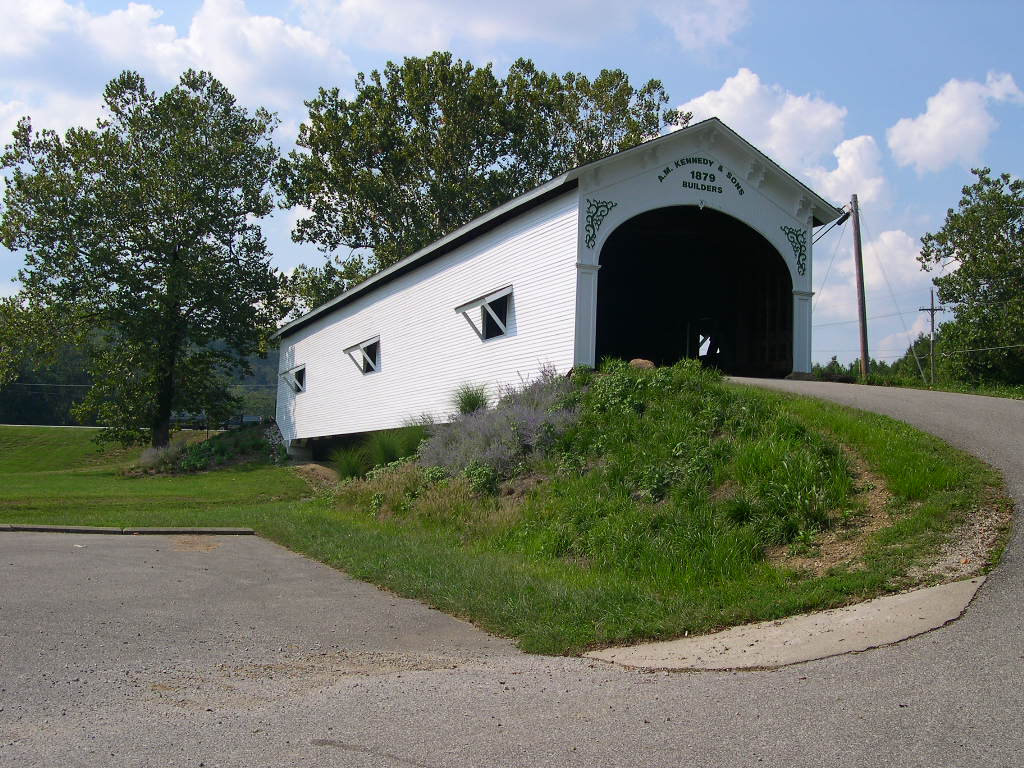
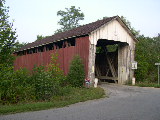
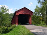
GUILFORD
BRIDGE 14-15-01#2, Burr Variation built in 1879, is located off
Rt. 1 at the NE of Guilford at a roadside park.
The
GPS location is N39 10.217 W84 54.512.
|
DECATUR
COUNTY
 |
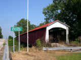
WESTPORT
BRIDGE 14-16-01, Burr Arch Truss, built in 1880, restored in 2004,
is located SE of Westport by 1 mile on bypassed section of CR
1100S.
The
GPS location is N39 10.013 W85 32.775.
|
FAYETTE
COUNTY
|
LONGWOOD
BRIDGE 14-21-01, Burr Arch Truss, built in 1884, is located in
the Northeastern section of Connersville in Roberts Park.
The
GPS location is N39 40.136 W85 07.714.
|
FRANKLIN
COUNTY
 |
STOCKHEUGHTER,
ENOCHSBURG BRIDGE 14-24-05, Howe Truss, built in 1887, is located
East of Enochsburg on Enochsburg Road (CR 1480W).
The
GPS location is N39 20.013 W85 16.861.
|
 |
SNOW
HILL, JOHNSON'S FORK BRIDGE 14-24-09, Howe Truss, built in 1885
and restored in 2010, is located North of Rockdale on Snow Hill
Road.
The
GPS location is N39 19.533 W84 51.112.
|
 |
SEAL,
BARN, BIG CEDAR CREEK BRIDGE 14-24-10, Queenpost Truss, built
in 1905, private, is located East of Brookville on Big Cedar Road.
The
GPS location is N39 24.340 W84 54.494.
|
 |
DUCK CREEK AQUEDUCT, CANAL BRIDGE 14-24-11, Burr Arch Truss, built
in 1846, is located in Metamora along Main Street.
The
GPS location is N39 26.768 W85 07.801.
|
JACKSON
COUNTY
 |
SHIELDSTOWN
BRIDGE 14-36-02, Burr Arch Truss, built in 1876, is located NE
of Brownstown along Crane/ Sheildstown Road.
The
GPS location is N38 54.914 W86 00.154.
|
|
|
BELLS
FORD BRIDGE 14-36-03, Post Truss, built in 1869, was located next
to Rt. 258 about 3.4 miles NW of Rt. 11 in Seymour. It has totally
collapsed. |
 |
MEDORA,
DARK BRIDGE 14-36-04, Burr Arch Truss, built in 1875, restored
in 2011, is located about a mile East of Medora on a bypassed
section of IN235.
The
GPS location is N38 49.114 W86 08.837.
|
JENNINGS
COUNTY
 |
SCIPIO
BRIDGE 14-40-01, Howe Truss, built in 1886, is located in Scipio
on CR757W.
The
GPS location is N39 05.076 W85 43.216.
|
 |
JAMES,
GRAHAM CREEK BRIDGE 14-40-02, Howe Truss, built in 1887, is located
SE of Lovett on CR650S.
The
GPS location is N38 53.580 W85 36.930.
|
RIPLEY
COUNTY
 |
HOLTON,
OTTER CREEK BRIDGE 14-69-02, Howe Truss, built in 1884, is located
on the west side of CR850W (Covered Bridge Road) NW of Holton.
The
GPS location is N39 05.116 W85 24.608.
|
 |
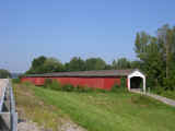
BUSCHING
BRIDGE 14-69-04, Howe Truss, built in 1885, rebuilt in 2005, is
located East of Versailles at the western edge of Versailles State
Park.
The
GPS location is N39 04.067 W85 14.275.
|
RUSH
COUNTY
|
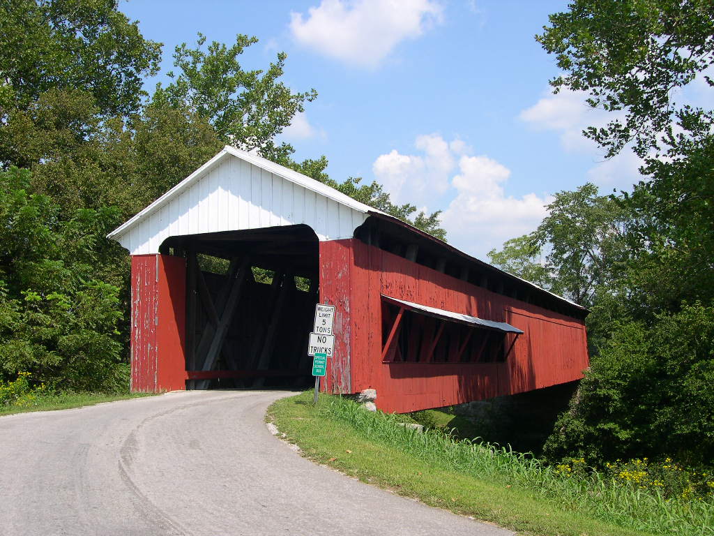
SMITH,
EWBANK BRIDGE 14-70-01, Burr Arch Truss, built in 1871, is located
about a mile NE of Rushville on CR150N.
The
GPS location is N39 38.010 W85 24.986.
|
|
OFFUTT'S
FORD BRIDGE 14-70-02, Burr Arch Truss, built in 1884, is located
about a mile NE of Arlington on Offutt Ford Road (CR475W).
The
GPS location is N39 39.625 W85 32.366.
|
|
FORSYTHE
MILL BRIDGE 14-70-04, Burr Arch Truss, built in 1888, is located
on CR650S WNW of Milroy.
The
GPS location is N39 31.037 W85 31.827.
|
|
MOSCOW
BRIDGE 14-70-07#2, Burr Arch Truss, built in 1886, rebuilt in
2002 and again in 2010, is located in Moscow on CR900S.
The
GPS location is N39 29.106 W85 33.30
|
|
NORRIS
FORD BRIDGE 14-70-08, Burr Arch Truss, built in 1916, is located
on CR100N NE of Rushville.
The
GPS location is N39 39.32 W85 24.57.
|
|
HOMER/BARN
BRIDGE 14-70-09, Multiple Kingpost Truss,built in 1881, &
re-built in 2009, is located SSW of Rushville in a parking lot
off CR200W.
The
GPS location is N39 33.442 W85 28.957.
|
|