| Addison
County |
click
on small photos to see larger photo!
|
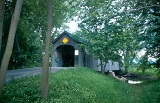 |
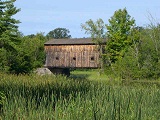
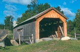
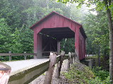
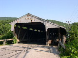
SALISBURY STATION BRIDGE 45-01-01, Town Lattice Truss, built in
1865, is located SE of Cornwall, on Swamp Road. It has been lost
to fire on September 10, 2016.
The
GPS location was N43 55.083 W73 10.437.
|
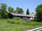 |
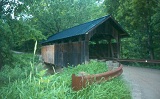
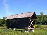
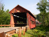
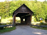
SPADE
FARM, OLD HOLLOW BRIDGE 45-01-02, Town Lattice Truss, built in c.
1850's, is located North of Ferrisburg, on the West side of the
US7.
The
GPS location is N44 14.248 W73 13.922.
|
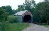 |
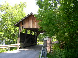
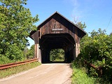
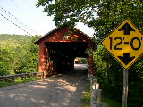
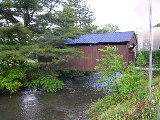
HALPIN,
HIGH BRIDGE 45-01-03, Town Lattice Truss, built in 1840, is located
NE of Middlebury, on Halpin Road.
The
GPS location is N44 03.009 W73 08.444.
|
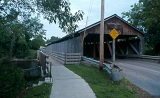 |
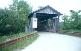
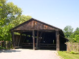
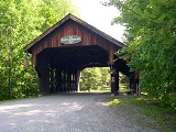
PULP
MILL, PAPER MILL BRIDGE 45-01-04#2, Very rare Burr Arch Truss, Double
Barreled , built 1853-54, is located at the northwestern edge of
Middlebury, on Pulp Mill Bridge Road.
The
GPS location is N44 01.471 W73 10.649.
|
 |
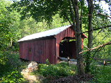
EAST
SHOREHAM RAILROAD BRIDGE 45-01-05, Howe Truss, built in 1897, is
located SE of Shoreham Center, on abandoned RR line adjacent to
East Shoreham Road.
The
GPS location is N43 51.58 W73 15.26.
|
| Chittendon
County |
|
 |
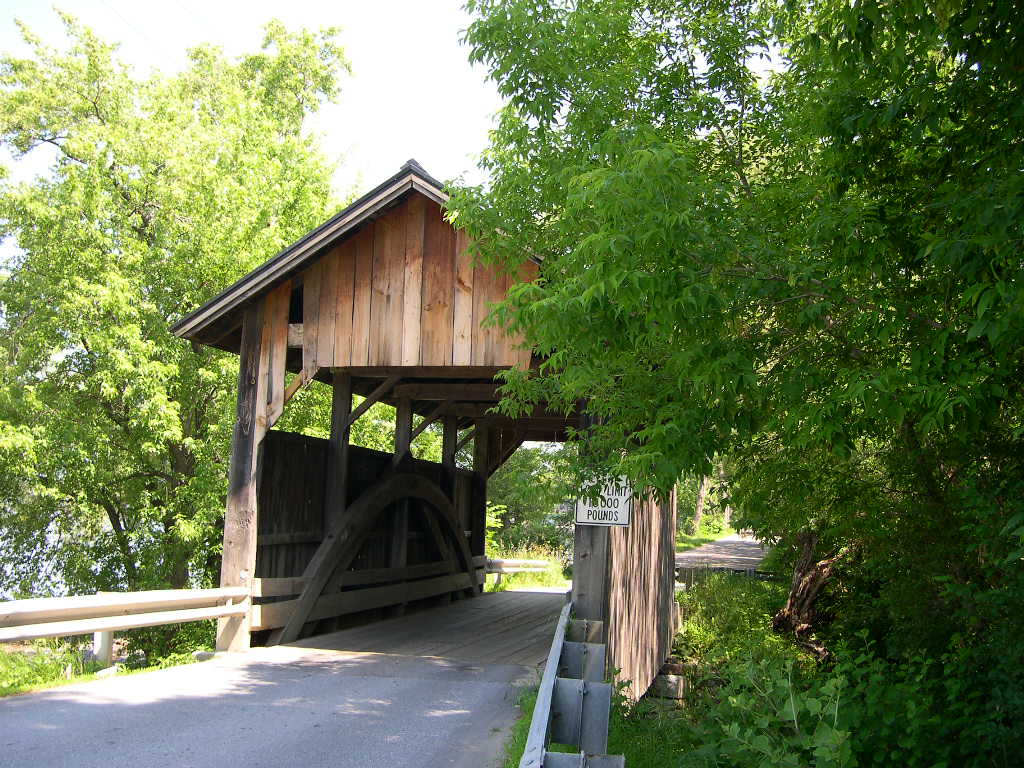
LAKE
SHORE, HOLMES BRIDGE 45-04-01, Very rare tied Arch construction,
built in 1870, is located NW of Charlotte, on Lake Road.
The
GPS location is N44 19.98 W73 16.93.
|
 |
UPPER,SEGUIN,
BROWN'S BRIDGE 45-04-02, Burr Arch Truss, built in 1850, is located
SW of Hinesburg, on Roscoe Road.
The
GPS location is N44 17.338 W73 09.009.
|
 |
QUINLAN,
LOWER BRIDGE 45-04-03, Burr Arch Truss, built in 1849, is located
on Lewis Creek Road, Se of Charlotte.
The
GPS location is N44 16.58 W73 11.03.
|
 |
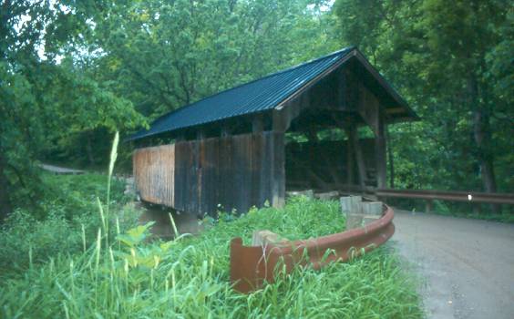
WESTFORD,
BROWN'S RIVER BRIDGE 45-04-05, Burr Arch Truss, built in 1837, restored
in 1988, is located in the Village of Westford, on bypasssed section
of Cambridge Road.
The
GPS location is N44 36.75 W73 00.45.
|
 |
CAMBRIDGE
VILLAGE, MUSEUM BRIDGE 45-04-06, Burr Arch Truss, built in 1845,
is located at the staff entrance to Shelbourne Museum at Shelbourne
on the west side of US 7.
The
GPS location is N44 22.60 W73 13.77.
|
| Washington
County |
|
 |
COBURN,
CEMETARY BRIDGE 45-12-02, Queenpost Truss, built in 1851, rehabilatated
with cement floor, is located ENE of East Montipelier on Coburn
Bridge Road.
The
GPS location is N44 16.850 W72 27.253.
|
 |
ORTON
FARM, MARTIN BRIDGE 45-12-06, Queenpost Truss, built in 1890, restored
in 2009, is located across the Winooski River, NE of Plainfield
on farm access road, off US 2.
The
GPS location is N44 17.252 W72 24.494.
|
 |
MOSELEY,
STONY BROOK BRIDGE 45-12-07, Kingpost Truss, built in 1899, is located
SW of Northfield Center on Stony Brook Road.
The
GPS location is N44 07.221 W72 41.352.
|
 |
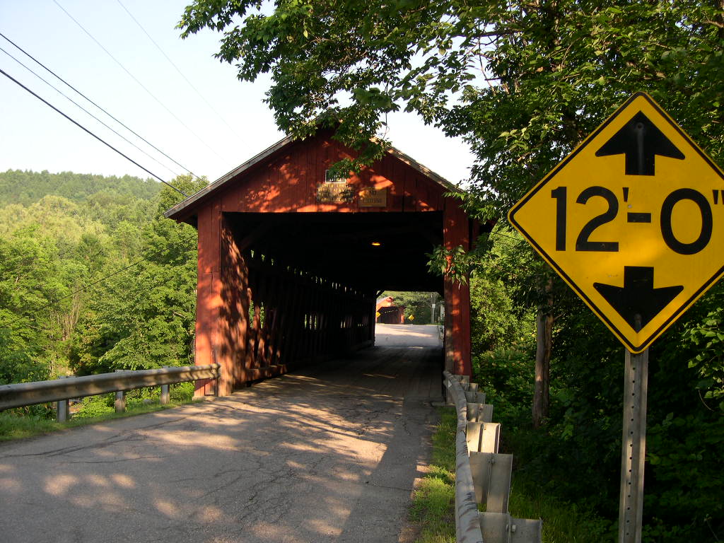
NORTHFIELD
FALLS, STATION BRIDGE 45-12-08, Town Lattice Truss, built in 1872,
is located at the Village of Northfield Falls, off VT 12, on Cox
Brook Road. It is a twin to the Newell bridge.
The
GPS location is N44 10.343 W72 39.080.
|
 |
SLAUGHTER-HOUSE
BRIDGE 45-12-09, Queenpost Truss, built in 1872, is located at the
southern edge of Northfield Falls on Slaughterhouse Road.
The
GPS location is N44 10.109 W72 39.268.
|
 |
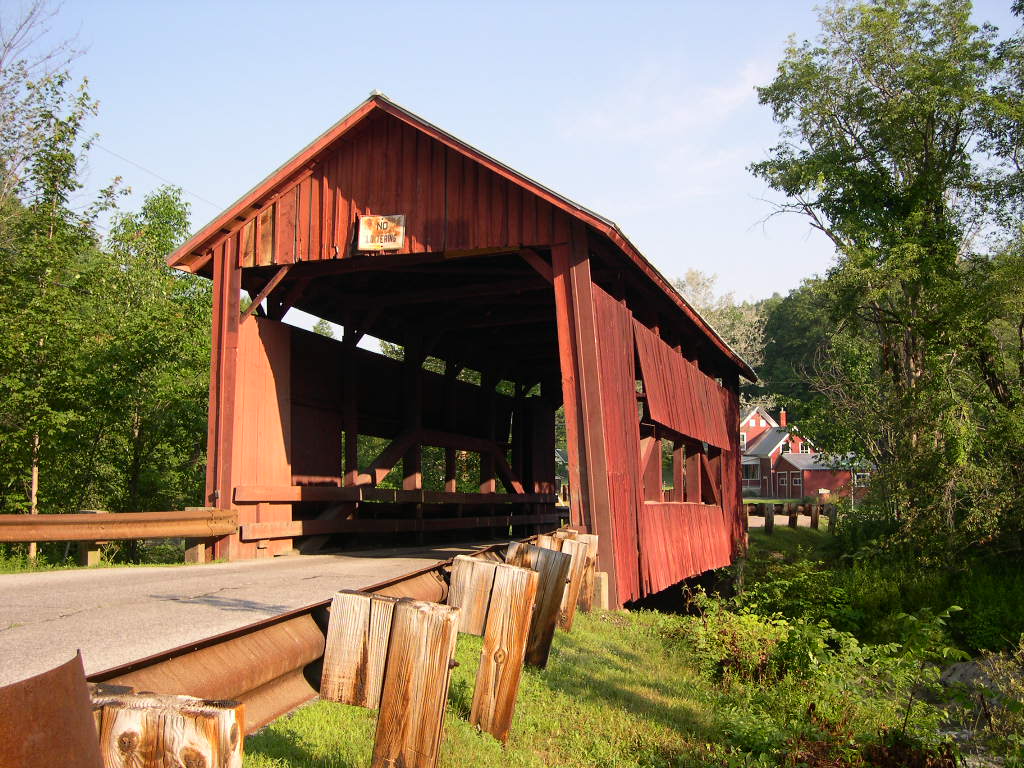
NEWELL,
LOWER BRIDGE 45-12-10, Queenpost Truss, built in 1872, is located
at Northfield Falls on Cox Brook Road. It is a twin to the Northfield
Falls bridge.
The
GPS location is N44 10.363 W72 39.176.
|
 |
THIRD,
UPPER COX BROOK BRIDGE 45-12-11, Queenpost Truss, built c. 1872,
is located at the western edge of Northfield Falls on Cox Brook
Road. It has been repaired due to damage from Tropical Storm Irene
in 2011.
The
GPS location is N44 10.424 W72 39.355.
|
 |
PINE
BROOK, WILDER BRIDGE 45-12-12, Kingpost Truss, built in 1872, is
located NE of Waitsfield off VT 100, on North Road.
The
GPS location is N44 12.336 W72 47.526.
|
 |
VILLAGE,
BIG EDDY BRIDGE 45-12-14, Burr Arch Truss, built in 1833, is located
at the Village of Waitsfield, off VT 100, on Bridge Street.
The
GPS location is N44 11.361 W72 49.408.
|
 |
WARREN
BRIDGE 45-12-15, Queenpost Truss, built in 1880, is located at Warren,
on Warren Village Road.
The
GPS location is N44 06.666 W72 51.418.
|
 |
ROBBINS NEST BRIDGE 45-12-18, Queenpost Truss, built in 1964 &
built by Robert Robbins. It is located along Route 302, on private
road, in East Barre.
The
GPS location is N44 10.71 W72 28.25.
|
 |
A.
M. FOSTER BRIDGE 45-12-75, Queenpost Truss, built in 1988, is
located on Cabot Plains Rd. (Private)
The
GPS location is N44 25.409 W72 16.104.
|
 |
BATTLEGROUND
BRIDGE 45-12-D, Stringer, built in 1974, is located in Fayston on
Battleground Road, along Route 17 between Irasville & entrance
to Mad River Glen.
The
GPS location is N44 12.07 W72 53.68.
|
Southern
VT | South
Central VT | Northeastern VT | Northwestern
VT | HOME
|


