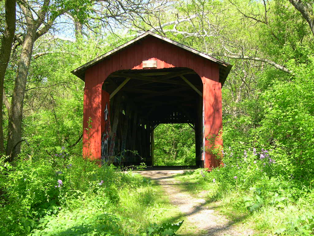
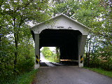
AUGLAIZE
COUNTY
 |
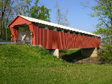
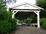
ST.
MARY'S, MEMORIAL PARK BRIDGE, 35-06-54, Howe Truss, built in
1992, is located at St. Marys, in Memorial Park.
The
GPS location is N40 32.572 W84 23.232.
|
DELAWARE
COUNTY
 |
CHAMBERS
ROAD BRIDGE, 35-21-04, Childs Truss, built in 1883, is located
NNE of Olive Green, on Chambers Road. (TR63)
The
GPS location is N40 20.298 W82 49.081.
|
FRANKLIN
COUNTY
 |
DIETZ,
BERGSTRESSER BRIDGE 35-25-03, Partridge Truss, built in 1887,
is located South of Canal Winchester on Ashbrook Road.
The
GPS location is N39 49.806 W82 48.993.
|
 |
WEAVER
PARK, FRANKLIN COUNTY FAIRGROUND BRIDGE 35-25-g, Town Lattice
Truss footbridge, built in 1993, is located at Franklin County
Fairgrounds.
The
GPS location is N40 02.164 W83 09.303.
|
GREENE
COUNTY
 |
CEMETERY
ROAD, GLEN HELEN BRIDGE 35-29-01, Howe truss, built in 1886,
is located SSE of Yellow Springs, in Glen Helen Nature Preserve,
on west side of Grinnel road. Park at gate and walk 300 feet
to bridge.
The
GPS location is N39 47.12 W083 52.68.
|
|
|
WEST
ENGLE MILL ROAD BRIDGE 35-29-03, Smith Truss, built in 1877,
is located ESE of Spring Valley, on bypassed section of Engle
Mill Road (TR 46).
The
GPS location is N39 34.908 W83 55.309.
|
 |
STEVENSON
ROAD BRIDGE 35-29-15, Smith Truss, built in 1877, is located
NNE of Xenia, on bypassed section of Stevenson Road (CR76).
The
GPS location is N39 44.099 W83 53.937.
|
 |
CHARLTON
MILL BRIDGE 35-29-16#2, Howe Truss, built in 1883, was located
WSW of Cedarville, on Charleton Mill Road (TR29). It was razed
and rebuilt in 2013.
The
GPS location was N39 43.759 W83 52.219.
|
 |
BALLARD
ROAD BRIDGE 35-29-18, Howe Truss, built in 1883, is located
WNW of Jamestown, on Ballard Road (TR6).
The
GPS location is N39 40.691 W83 48.897.
|
 |
CLIFTON
MILL BRIDGE 35-29-B, Stringer, built in 1996, is located along
Water Street.
The
GPS location is N39 47.627 W83 49.525.
|
 |
RICHARD
P. EASTMAN or HYDE ROAD BRIDGE 35-29-109, Howe Truss, built
in 2014, is located 1.6 miles south of US68 at Yellow Springs
on Corry St., then just left on Hyde Road.
The
GPS coordinates are N39 47.114 & W83 53.198.
|
LOGAN
COUNTY
 |
McCOLLY
BRIDGE, 35-46-01, Howe Truss, built in 1876, is located SW of
Lewistown, on CR13.
The
GPS location is N40 24.064 W83 55.459.
|
 |
BICKHAM
BRIDGE, 35-46-03, Howe Truss, built in 1877, is located East
of Russell's Point, on CR38.
The
GPS location is N40 28.466 W83 50.427.
|
MIAMI
COUNTY
 |
ALLEN'S
MILL, ELDEAN BRIDGE 35-55-01, Long Truss, built in 1860, is
located North of Troy, on bypassed section of Eldean Road (CR33).
The
GPS location is N40 04.675 W84 12.990.
|
 |
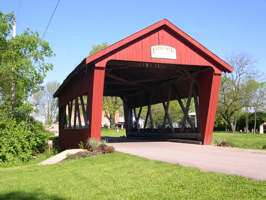
FLETCHER
BRIDGE 35-55-A, Smith Truss with support beams, built in 1998,
is located in Fletcher, on Downing Street.
The
GPS location is N40 08.780 W84 06.762.
|
MONTGOMERY
COUNTY
 |
GERMANTOWN
BRIDGE 35-57-01, Inverted Bowstring Truss, built in 1870, is
located at Germantown, on East Center Street.
The
GPS location is N39 37.573 W84 21.898.
|
|
|
FEEDWIRE,
CARRILON PARK BRIDGE 35-57-03, formerly OH-29-09, Smith truss,
built in Greene County in 1870 & moved to present location
in 1948. It is located in Dayton, at Carillon Historical Park,
at 2100 Patterson Blvd.
The
GPS location is N39 43.680 W84 12.146.
|
 |
JASPER
ROAD BRIDGE 35-57-36, formerly 35-29-26, Smith Truss, built
in 1869, was moved from Greene County in 1964. It is located
at the Southwestern edge of Germantown, at 11345 Oxford Road.
The
GPS location is N39 37.009 W84 23.341.
|
PICKAWAY
COUNTY
|
|
VALENTINE
BRIDGE (PRIVATE) 35-65-15#2, formerly OH-23-44, Multiple Kingpost
Truss, built in 1887, is located SSE of Harrisburg & Orient,
on the Bill Green farm. Walk 0.3 miles to bridge. (Private)
The
GPS location is N39 46.486 W83 07.695.
|
|
|
BRANNON,
WESNER, BLACKBURN BRIDGE 35-65-16, Multiple Kingpost Truss,
built in 1885, is located NNE of Grove City, in Buzzard Roost
area of Slate Run Metro Park.
The
GPS location is N39 45.75 W082 50.87.
|
PREBLE
COUNTY
 |
HARSHMAN
BRIDGE 35-68-03, Childs Truss, built in 1894, is located North
of Fairhaven, on Concord/Fairhaven Road (TR218).
The
GPS location is N39 41.988 W84 46.172.
|
 |
DIXON
BRANCH BRIDGE 35-68-04, Childs Truss, built in 1887, is located
at the Eastern edge of Lewisburg, in Cavitan Park, on north
side of Salem Road (CR 15).
The
GPS location is N39 50.74 W084 32.13.
|
 |
ROBERTS
BRIDGE 35-68-05, Burr Arch Double Barrel Truss, built in 1829,
damaged by arson in 1986 & later restored, is located in
Eaton, on St. Clair Street, in Crystal Lake Park, off US 127.
The
GPS location is N39 44.430 W84 38.322.
|
|
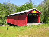
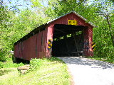
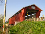
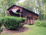
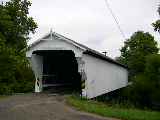
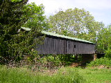
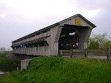
BRUBAKER
BRIDGE 35-68-06, Childs Truss, built in 1887, is located WNW
of Gratis, on Brubaker Road (TR328).
The
GPS location is N39 39.095 W84 32.638.
This photo of the Brubaker Bridge was taken by Jeff Galey after
the re-construction.
|
 |
CHRISTMAN
BRIDGE 35-68-12, Childs Truss, built in 1895, is located NNW
of Eaton, on Eaton/New Hope Road (TR142).
The
GPS location is N39 46.217 W84 39.306.
|
 |
GEETING
BRIDGE 35-68-13, Childs Truss, built in 1894, is located West
of Lewisburg, on Price Road.
The
GPS location is N39 50.620 W84 35.828.
|
 |
WARNKE
BRIDGE 35-68-14, Childs Truss, built in 1895, is located NNE
of Lewisburg, on Swamp Creek Road (TR403).
The
GPS location is N39 52.420 W84 30.875.
|
|
HUESTON
WOODS 35-68-51, built in 2012, is located in College Center
on Eaton Street.
The
GPS location is N39 35.52 W084 46.23.
|
SCIOTO
COUNTY
 |
OTWAY
BRIDGE 35-73-15, Smith Truss w/arches added in 1896, is located
at the Western edge of Otway, on bypassed section of OH348.
The
GPS location is N38 51.770 W83 11.407.
|
UNION
COUNTY
 |
UPPER
DARBY, POTTERSBURG BRIDGE, 35-80-01, Partridge Truss, built
in 1868. It
has been relocated to North Lewisburg Trail on July 17, 2006,
on CR163 (Inskeep Cratty Rd.) 0.9 miles to the bridge on the
W. side of the road.
The
GPS location is N40 14.438 W83 31.724.
|
 |
SPAIN
CREEK BRIDGE, 35-80-02, Partridge Truss, built c1870, is located
ENE of North Lewisburg, on Cratty Road (CR163).
The
GPS location is N40 13.74 W83 31.38.
|
 |
CULBERTSON,
WINGET ROAD, TREACLE CREEK BRIDGE, 35-80-03, Partridge Truss,
built in 1868, is located NE of Irwin, on dead end Winget Road
(TR82).
The
GPS location is N40 08.285 W83 27.141.
|
 |
AXE
HANDLE ROAD, BIGELOW, LITTLE DARBY BRIDGE, 35-80-04, Partridge
Truss, built in 1873 by Russell L. Partridge, is located West
of Chuckery, on Axe Handle Road (CR87).
The
GPS location is N40 06.950 W83 25.509.
|
|
|
NEW UPPER DARBY BRIDGE, 35-80-61, Modified Pratt Truss, built
in 2007 is located on CR163 (Inskeep-Cratty Road).
The
GPS location is N40 14.956 W83 32.000.
|
|
BUCK
RUN ROAD, 35-80-62, Modified Pratt Truss, built in 2006, is
located on Buck Run Road, West of Marysville.
The
GPS location is N40 12.602 W83 29.323.
|
|
MILL
CREEK BRIDGE 35-80-63, Modified Pratt, built in 2010, is located
SW of US30 on Thompson Rd.
The
GPS location is N40 14.56 W083 14.02.
|
|